After 2 1/2 days in Shelburne in the rain and fog it was time to move on. The weather forecast for the next week was for more rain and fog so our departure criteria became 30 hours of fair wind to Halifax.

Ocean Sunfish
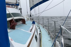
Clearing Eastern Way, the entrance to Shelburne, we set a full main and Genoa for a close reach in a force 3-4 southerly giving us a pleasant and uneventful overnight sail until the weather gods shut off the wind forcing us to motor the last 30 miles into Halifax.

St. Peter’s Marina
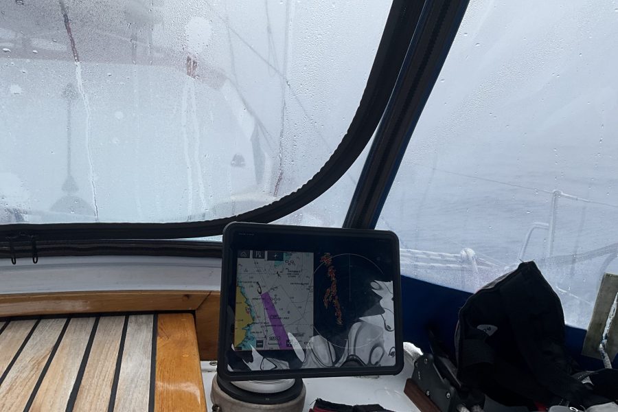
As we approached Halifax harbor entrance and it’s traffic control scheme we contacted Halifax Traffic Control to let them know we were entering the harbor. Traffic control informed us there wasn’t any commercial traffic moving about in our area which considering the 1/16 mile visibility removed a bit of stress. Traffic control keeps a pretty good watch via AIS and radar on all vessels moving about in the approaches and main harbor. They will let you know of any vessel moving about around you and that information along with your own radar and AIS gives you a pretty clear picture of what you need to do to have a safe passage, especially in the reduced visibility we were experiencing.
Now usually when you get close to land the fog lifts or at least thins, not this fog! As we approached the narrow, 1/4 mile or less, Northwest Arm of Halifax Harbor we expected visibility to improve, nope, visibility remained nil so knowing there was deep water right up to the shore and using radar we turned left until we could just make out the steep rocky shore and a line of mooring balls which we were able to follow to our assigned mooring at the Royal Nova Scotia Yacht Squadron.
After securing to a mooring, getting the boat and ourselves somewhat presentable we gathered up our shower gear and headed for shore and the dock masters office to check in. There we learned that tomorrow, July 1st is, Canada Day, a national holiday with all stores closed! Our plan had been to shower and go to sleep, do our shopping on Saturday and depart on Sunday, now we were going to shower and go shopping. With the holiday falling on a Saturday, few stores were going to be open before Tuesday, as like the US the Canadians like long holiday weekends.
Halifax is a beautiful city but doesn’t really have any place for recreational boats to anchor. In the main harbor there are docks along the downtown waterfront that are very close to shopping, public transportation and historical sights but since our last trip here have become rather expensive, especially considering they don’t have any amenities, like hot showers! On our first trip to Canada in 2019 we stayed here for a reasonable price and were fortunately given one of the only three berths protected from what are sometimes pretty violent boat wakes as the adjacent harbor doesn’t have any “NO WAKE ZONES”
In the Northwest Arm of the harbor there are two yacht clubs, offering moorings and docks, the Armdale Yacht Club and the Royal Nova Scotia Yacht Squadron. Only the RNCYS offers moorings, they also have limited dock space but it is too expensive for our budget. The disadvantage of the Northwest Arm is its lack of public transportation and its distance from shopping centers.
Shopping at this time was important, especially for the many food items you are not allowed to bring into Canada. Meats have to be labeled grown in the US or Canada, in original packaging, fresh produce and dairy items are also not allowed. Our freezer size requires us to repackage in meal size packages which left them liable for confiscation should customs come aboard. Both times we have cleared into Canada we did so by phone so no Customs Officers have ever boarded us upon entry, however, two boats that cleared at Shelburne an hour after us were met and boarded by Customs Officers.
After a nice hot shower we got a ride from one of the locals working at the Yacht Club to The Binnacle, the local Chandler, where we planned to pickup charts of Newfoundlands south shore. The last time we were here we gave them the chart numbers we wanted and they printed them up for you while you waited. Unfortunately, Canada no longer allows chart agents to print charts and as Newfoundland is a ways off the Binnacle only stocks one each of Newfoundland charts and someone else with the same idea as us had already bought all they had. They had more on order but didn’t expect them for at least a week, much longer than we planned to be in Halifax.
On our way back to the yacht club we learned the grocery was much nearer than we realized but our driver needed to return to work so upon our return to the yacht club we called a Uber for our shopping trip to Sobey’s Market for meats and fresh produce. Sorbey’s is a full size grocery, though by US standards your choices are a bit limited, unless you want junk food which like everywhere is in abundance. They did have a decent meat selection and Keely found most of the fresh veggies she wanted. Prices were reasonable, and considering the exchange rate more or less on par with the US.
Returning to Malaya we spent the next couple of hours repacking our meats into individual meal size vacuum sealed packages, stowing dry goods and veggies, watched a movie and went to sleep. The next morning, Canada Day, we jugged water to top off our water tanks, tried to dry out a bit when the sun peaked out for an hour in the afternoon, laid out our course to St. Peter’s and rested.
Sunday morning at 0820 we cast off the mooring, again in heavy fog, contacted Halifax Traffic and headed for the harbor entrance steering by compass. Halifax Traffic warned us of a couple of approaching sailboats, which we eventually picked up on radar, both past unseen a quarter mile away. We were also told of some commercial shipping moving about but none passed close enough to concern us.
Leaving Halifax to go along the Eastern Shore of Nova Scotia is a much shorter trip through the harbor than arriving from the west so we were clear of all traffic inside an hour. Reaching the bell at the southern end of Thrumcap Shoal we turned east and laid a course to keep us about 4 miles off the coast and it’s outlying dangers for Cape Canso.
The Grib charts all showed we shouldn’t expect any wind until mid-afternoon so we motored along in the fog on flat seas. Occasionally the fog did thin out, giving us a somewhat better view of the ocean around us, but no land. We spent our watches watching the birds, Greater Shearwaters, Fulmars and Bufflehead Ducks gracefully flying around us, occasionally we spotted the fin of Ocean Sunfish but otherwise the sea was empty.
Once the wind returned around 1430 we had a glorious close to beam reach making 6.5+ knots for hours on end, on a very comfortable sea.
Overnight we had spells where the fog lifted giving us a view of the moon, an occasional glimpse of the horizon and for once a clear view of another vessel passing us, but the fog always returned after teasing us.
On Monday morning as we approached Cape Canso the sea got very lumpy with no rhythm to the seas, something we have experienced every time we have sailed past Cape Canso. While the chart doesn’t show it I suspect these tidal overfalls are from the meeting of the Labrador Current and the tidal currents flowing in and out of Canso Strait.
Fortunately, on this passage of Cape Canso the wind wasn’t strong enough to whip up a big sea but, had enough strength to keep us moving and in control. As the distance around the Cape is relatively short we out of the rough seas in a couple of hours and into the Canso Strait.
Crossing the Canso Strait there is again the chance of encountering large commercial vessels but the only one in the area was safely passing behind us as we made the 8 mile crossing. After crossing the strait with the wind going light we doused all sail and motored the last 10 miles into St, Peter’s Bay.
Entering and transiting St. Peter’s Bay in clear weather requires one to pay close attention to courses as the channel is surrounded by shoals, has several sets of markers all a mile or so apart requiring several course changes. We had already laid out the required courses so it was just a matter of finding the various markers on radar as we approached each set. With Keely in the bow keeping a lookout we found each one as they popped out of the fog less than an 1/8 mile off.
As we approached the end of St. Peter’s bay we again hoped the proximity of land would burn off the fog so we could find our way into the Lock channel but, no, so again using radar and the chart plotter we made the 90 degree right hand turn at the end of St. Peter’s Bay towards the hundred yard wide opening for the Lock channel and it’s adjacent 90 degree left hand turn into the lock.
Finally as we entered the opening we were able to see the surrounding land, make the turn towards the lock and tie up along the concrete wall while we awaited for the lock to open. As usual the lock staff was very helpful and friendly, helping us tie up and carrying on a conversation while the locks closed and lifted us a foot or so to the lake level. After they open the locks going into the lake you have to wait in the lock while the staff drives down to the highway bridge a half mile away to stop traffic and open the bridge.
Once the bridge is open you are free to leave the lock and motor down the channel, which was blasted out of solid rock, with a vertical rock wall to your right and a 50’ tall bulkhead to the left holding back a steep grassy slope. The passage being just wide enough for two boats to squeak by each other.
At the end of the channel we turned left for Strachans Cove and a mooring off the St. Peter’s Marina.
St. Peter’s at the very southern end of the Bra’s d’Or Lakes, has things most people need in way of groceries, banks, pharmacy, restaurants, hardware store and a very friendly marina with the most important item of all for cruisers, hot showers!


Leave a Reply
Your email is safe with us.