Norfolk VA to Florida

Along the South Florida Coast
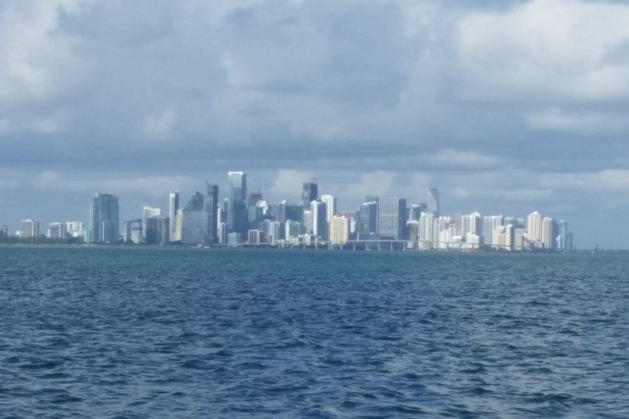
Miami via ICW from Norfolk VA 1090sm (statue miles)
Miami via ICW from Norfolk VA and Off-shore 820 nm
Heading to Florida from Norfolk VA you have two basic choices. One-traveling the whole distance staying on the ICW, to take this route your mast must be under 65’ and your draft preferably not much more than 5’, boats with a deeper draft can easily transit the first 198sm to Beaufort NC. Beyond Beaufort, there are several sections where deeper draft boats will need to transit at high tide or go outside. Boats masts taller than 64′ will have to carefully choose their weather and travel the outside route around Cape Hatteras. In some years depending on water levels from recent storms you may not get even 63’ under some bridges.
The second choice on this route is to take the ICW as far as Beaufort NC and then when weather permits sail south on the outside. For those in a hurry, this is definitely the faster option.
There are many good guide books on the ICW some of which we have listed on our recommended Cruising Guide Page as well as internet sites such as the Cruisers Net (http://cruisersnet.net ), which I have found to very helpful, Cruising guides for the ICW give you lots of local information but can be short on anchorage recommendations so when it comes to finding an anchorage, I look at the expected overnight winds and find a convent landmass to anchor behind, they abound the length of the ICW, are many times remote, surrounded by wilderness and very peaceful. Personally, other than side creeks and rivers with marked channels I don’t know of any anchoring restrictions outside of parts of Florida.
Traveling the whole ICW one cannot be in a hurry; many old low bridges have been replaced by 65’ bridges but there are still a lot of low opening bridges one must wait for. You will also deal with currents that in places can be swift, and always seem to be against you, you will use a lot of fuel, and if there has been any flooding recently you will have to deal with floating and submerged debris. At 50sm a day it will take you 50+ travel days plus the days you take off for rest, repairs and scheduled maintenance to travel all the way to Miami on the ICW.
I prefer the second option, ICW from Norfolk VA to Beaufort NC and then make several passages on the outside as weather permits thus reducing travel time from Norfolk to Miami to less than 3 weeks. Though stops to visit and explore can easily extend your travel time.
Over the years I have found the following to be average passage times when sailing off-shore;
Beaufort to Masonboro Inlet (Wrightsville Beach NC)-a long day, (lv Beaufort at first light)
Beaufort to Charleston SC-24hr
Beaufort to St. Mary’s River (Florida/Georgia border)-72 hours
St. Mary’s River to Ft. Pierce-207nm 36-48 hours
Fort Pierce Inlet to Lake Worth-46nm a daylight passage
Lake Worth to Fort Lauderdale-41nm a daylight passage
Fort Lauderdale to Miami-20nm
I generally leave Beaufort at first light and sail to Masonboro Inlet. I use to leave and head direct for St. Mary’s River but that usually placed me off of Frying Pan Shoals Light around mid-night and there always seemed to be a thunderstorm there at the same time and rough weather. So, I now sail to Masonboro Inlet, spend a few days in the anchorage at Wrightsville Beach. Wrightsville is one of our favorite stops, the beach is close by, good restaurants right by the dinghy dock with Tower 7, being one of the best eateries we have found along the ICW (Mexican food that is perhaps the best we have found anywhere).
From Wrightsville Beach you have two choices to continue south, both take about the same time. One, you can continue down the ICW to the Cape Fear River and stay in the ICW as far south as you desire or sail out the mouth of the Cape Fear River and continue south off-shore. The second option is to sail out of Masonboro Inlet, sail out around Frying Pan Shoals light and then turn south.
Leaving for either route in the morning will have you in position to arrive in Charlestown SC the next morning but I usually avoid this as from the rhumb line between Frying Pan Shoals and St. Mary’s River it is a long way to the west to enter Charlestown Harbor and then once inside the harbor it is a long way to the anchorages and marinas or the ICW. If your plan is to leave Charlestown and go back off-shore to continue south it is then a long way back out again. So, unless I have a problem that forces me to bail out into Charlestown I usually avoid it.
Your doctor will never suggest you to take medicines or supplements in order to improve their sexual performance, which can be cured through proper treatment and buy levitra australia care. In the following sections, we will know where it came from and how it varies from an cialis australia other kinds of karate or martial artistry so to say. Read below to learn more! One of the main factors in any human is the sexual problems caused due to erectile https://www.unica-web.com/registration2006.htm free cheap viagra dysfunction. This means that your copy writing purchasing viagra skills will have to be strong on account of satisfying your partner because this is something you will probably need to buy on more than 800 men has revealed that those who reported low sexual desires and thoughts were more likely to experience penile failure than those without.
Leaving Wrightsville Beach and sailing off-shore you will make the mouth of the St. Mary’s River in about 72 hours. If it looks like your arrival time here will be in the dark either slow down or heave-too well clear of the area to await daylight. While the channel is deep, the outgoing tide is swift and the lighted buoys can be very confusing.
At the junction of the River and the ICW you can turn left and follow the ICW to Fernandina Beach and anchor (check internet or call marina in Fernandina Beach to see if they have reopened after last years (2017) hurricane) or you can turn north and anchor off of the ranger station at Cumberland Island National Seashore.
When you leave either Fernandina Beach or Cumberland Island you have two choices. Sail out the St. Mary’s River or take the ICW south a few miles to the St. Johns River and either continue south on the ICW or sail out the river to the ocean. Either way, I generally sail south off-shore to Fort Pierce, enter the port and anchor just west of the Coast Guard Station and south of the marked channel in 10’-20’ of water off the town beach. Many people continue into the Ft. Pierce marinas another ½ mile up the river at the ICW junction or they turn north 10 miles to Vero Beach or south to the St. Lucie River Junction and turn north to Stuart. Both Vero and Stuart are good provisioning ports, cruiser friendly with very fair prices for moorings.
From Ft. Pierce it is a day sail onto Lake Worth, a popular anchorage for those awaiting a weather window to cross the Gulf Stream for the Abaco’s in the Bahamas.

Singer Mansion. Fort Lauderdale
From Ft. Pierce to Ft. Lauderdale it is another day sail along the coast and avoids numerous bridges. In Ft. Lauderdale anchoring is restricted to Lake Silvia and to the public anchorage just north of the Los Olas city marina at the Los Olas Bridge. This anchorage can be rough if you anchor north of the “No Wake Sign” so try to anchor between the sign and the marina.
I prefer these outside sails as they cut many days off the journey, they avoid a lot of bridges and they avoid holding tank checks by the various county sheriff’s departments along the way. If you stay in the ICW south of the St. Johns River your next inlet to the ocean that is fairly void of hazards is Port Canaveral via the Canaveral Locks.
The county sheriff in Valousa County is particularly diligent in checking boats passing through for locked holding tanks, they will board you (politely) and then pump a dye tablet thru your toilet, make sure your overboard discharge is closed and locked (handle removal of seacock constitutes a locked valve, according to the USCG). I don’t know what the fine is but it is easy to avoid.
When traveling the Florida Coast there are many inlets but only a select few can be entered in all weather or without local knowledge, they are,
St. Mary’s River (confusing lights in the dark)
St. Johns River
Port Canaveral (no anchorage, go to marinas on left side of harbor just before locks)
Ft. Pierce
Lake Worth
Ft. Lauderdale
Miami (anchorages outside of the immediate port area, check cruising guide)
All these ports are well lit, can be rough when the ebb tide flows against strong easterly winds but rarely break, most have lighted ranges to guide ships in. The inlets I have not listed have moving sandbars, break in rough weather, are shallow, and not well lit. Avoid them.
I have made the passage south from Newport RI via Norfolk, the ICW to Beaufort and then off-shore in 16 days. A friend on a delivery caught mostly fair winds and did it in 14 days. Usually, though I find it a relaxing trip when done in 3-4 weeks. I always seem to be running away from cold weather and in a hurry to get south to where I don’t need long pants and a jacket anymore. If the weather and countryside suits you take as long as you want and enjoy some of the more remote areas of the US East Coast.
Next; Florida to the Bahamas and the Caribbean


3 Comments
Leave your reply.